 Roman Fort Kleiner Feldberg
The Feldberg Fort was the highest garrison on the Upper Germanic-Raetian Limes. With its stone remnants and artifacts, the UNESCO World Heritage site in the High Taunus region not only tells the story of Rome‘s military history, but also of its history of rule on the border with the “barbarians”.
History
History The UNESCO World Heritage Site “Frontiers of the Roman Empire” combines Hadrian’s Wall and the Antonine Wall in Great Britain and the Upper Germanic-Raetian Limes in Germany. The latter runs for 550 kilometres through 20 districts between the Rhine and the Danube. During the heyday of the giant empire, this borderline was extended or rebuilt in phases between 100 AD and the end of the 3rd century. What remained of the palisade fences and stone defence walls, ditches and ramparts, forts, guard posts and wooden towers were mainly remains in the ground.
Hesse accounts for 153 kilometres of the monument and its best-preserved section is in the Taunus. There lies the well-restored Feldberg fort with relics of Rome’s military architecture. At 770 metres above sea level, it was once the highest fortress on the Limes. When the pressure of “barbarian” Germanic tribes increased after the middle of the 2nd century, it was built in a forest between Kleiner and Großer Feldberg at the “Rotes Kreuz” pass, municipality of Schmitten.

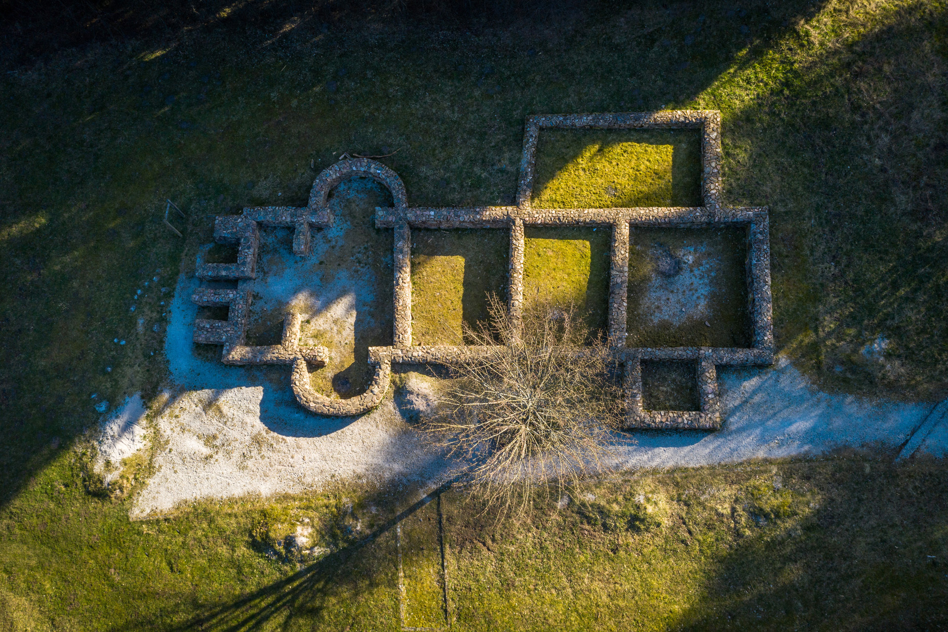
View of the central staff building with flag shrine, two gates and the storage building
Foto: Michael Leukel, 2020
A partially mounted reconnaissance unit of 150 to 200 men called “expl[oratio] Halic[] Alexandriana” was stationed in the garrison. “Halic” is now considered by recent research to be a shortened proper name of its location and no longer a reference of the troops to Hungary, as previously assumed. What did the Feldberg fort originally look like? On a rectangular ground plan (78 x 93 metres), surrounded by a ditch, it had corner towers, four gates and the typical interior buildings of Roman camps such as the main building “principia”. Nearby there was once a village divided into two sites, a burial ground and a cistern.

-
West gate, view from inside
Foto: Michael Leukel, 2020

-
View over defence walls towards the rear gate, the porta decumana
Foto: Michael Leukel, 2019
The fort’s defences, the apse of the flag shrine and sections of the walls of the commander’s house and the storehouse have been preserved. Also exposed are the remains of a “balnearium” in front of the fort with cold, warm and hot baths. Today, the site is presented as an archaeological park landscape and is easily accessible via a Limes hiking trail.

-
Foundation walls of the baths
Foto: Michael Leukel, 2020

-
The walls of the balnearium in front of the fort
Foto: Michael Leukel, 2020

-
Close-up view of the foundation walls of the balnearium
Foto: Michael Leukel, 2019
However, an excursion is not complete without a visit to the reconstructed Saalburg Fort, whose museum houses many finds from the Feldberg garrison. Great history becomes tangible in an exemplary way: For example, by means of the bronze letters with the name of the fratricide and terror ruler Caracalla (r. 211-217) once attached to an archway, or by means of a votive stone for the emperor’s mother Iulia Mamaea. She and her son, Severus Alexander, who reigned from 222-235 AD, were murdered and their memory subsequently erased in many places. Iulia’s stone was also removed from its honoured place in the fort.

The votive stone of Iulia Mamaea is on display in the Saalburg Museum
Foto: Carsten Amrhein, 2020


