 Roman Fort Kapersburg
What elsewhere fell victim to agriculture is well preserved in the forests of the Hessian Taunus. Rome’s military fortifications such as the Kapersburg near Rosbach vor der Höhe give an idea of the Limes in late antiquity. At that time they were sentry and scout posts, today they are cultural monuments within the UNESCO World Heritage Site “Frontiers of the Roman Empire”.
History
In the protective forest areas of the Taunus Mountains, some posts of the late antique Roman military border wall have been particularly well preserved. In addition to the Feldberg fort, these include the former garrison of Kapersburg. It lies so remotely to the west of Rosbach vor der Höhe in the Wetterau district of Hesse that it can only be reached on foot. The Kapersburg is worth a visit, however, because it is a part of the Upper Germanic-Raetian Limes, which runs for 550 kilometres over 20 districts between the Rhine and the Danube: Its visible traces, especially the preserved and restored building relics in the terrain, make Rome’s history vivid. Today, the Limes is part of the transnational UNESCO World Heritage Site “Frontiers of the Roman Empire” and the Kapersburg archaeological monument tells of both condensed fortification and the creeping end of the frontier with the Germanic tribes.

Kapersburg Fort is located in a clearing in front of a hill called Saukopf (“Sow’s Head”) in the Taunus.
Foto: Elke Löhning, 2015

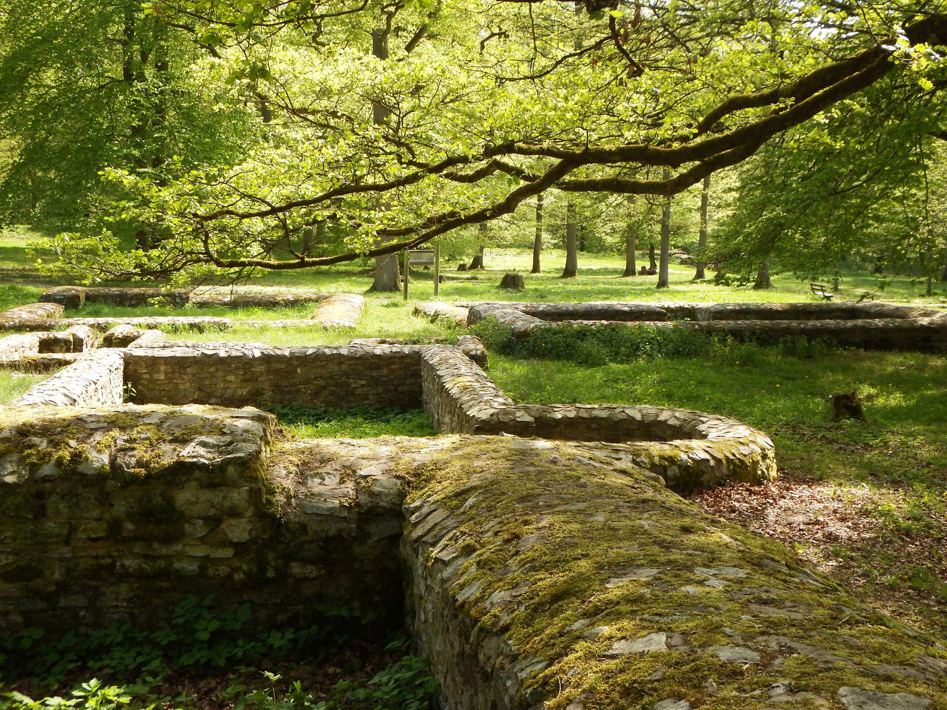
The fort occupies an area of 134 by 122 metres.
Foto: Elke Löhning, 2015

At the end of the 19th century, the foundation walls were secured and completed by 2005.
Foto: Katarina Papajanni, 2015
Guard Soldiers Probably Came from What Is Now Frankfurt
From the 1st to the 3rd century, the fort was the location of the “Numerus N”, a mobile unit of 150-200 scouts with an attached equestrian detachment. The remains of an inscription could refer to “Nidensium”, the nearby Nida (Frankfurt a. M. Heddernheim / Praunheim), where soldiers were recruited. The Kapersburg was built in stone with a rectangular ground plan covering 1.6 hectares (134 x 122 metres). The defensive ditches are still visible all around, and the enclosing wall and gates remain on the west and east sides. Of the buildings, the administrative rooms of the staff building (Latin: principia), the granary (horreum), wells, a crew barrack and other foundations have survived. A camp village outside extended on all sides, especially to the east. The only remaining structure of the village used by soldiers and the population is the bathhouse.

-
The foundations of the bathhouse
Foto: Elke Löhning, 2015

-
View of the walls of the rooms inside the staff building
Foto: Elke Löhning, 2015

-
The Kapersburg garrison is located about seven kilometres from the Saalburg Roman fort.
Foto: Elke Löhning, 2015
The archaeological park contains buildings from various periods, as the fort with its preceding wooden garrison was extended several times. It possibly replaced – for subsequent border protection – the small fort of Ockstädter Wald, 700 m to the north, which struggled with water supply. In its late period, in the second third of the 3rd century, the Kapersburg was finally significantly reduced. During this period, to which research dates the long process of the fall of the limes, a decimated force retreated to the fortress-like north-eastern corner. A ditch for the smaller area was no longer completed.


